Oslo, August 23
Morning in Oslo
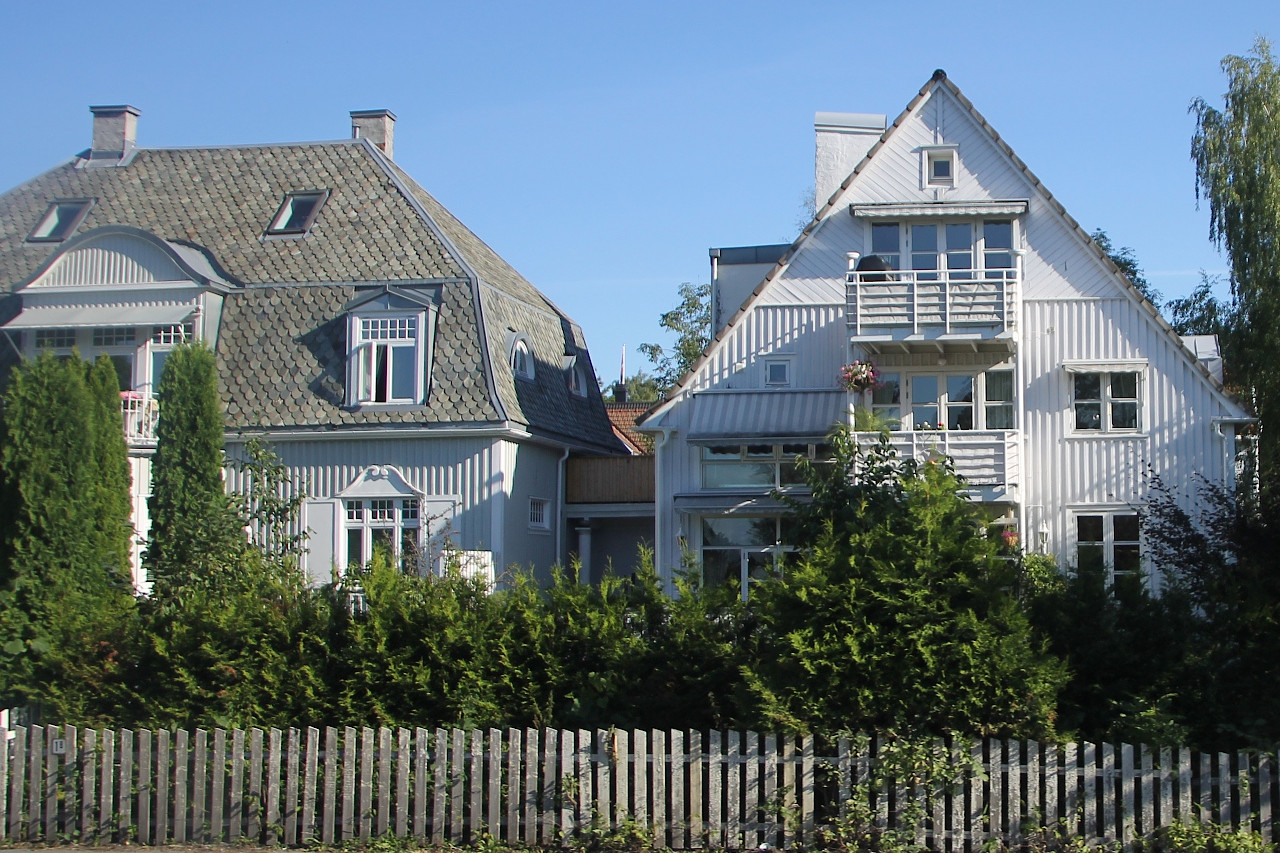
After spending the night in a suburban hotel, we start exploring the
Norwegian capital early in the morning. Most of Oslo is not much
different from small Norwegian cities and is built
up with low-rise wooden houses, surrounded by greenery...read more 
Oslo Opera House (Operahuset)
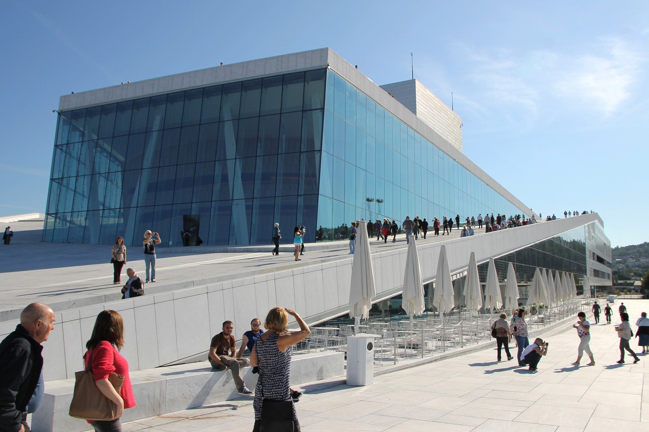
On the north shore of the Bjørvika bay is the National Opera house of
Norway (Operahuset), the main venue of the National Opera and ballet and
the Norwegian academic Opera house. It is a masterpiece of modern
Norwegian architecture and the largest public building built in Norway
since the construction of the Nidaros Cathedral...read more 
Operaen Embankment
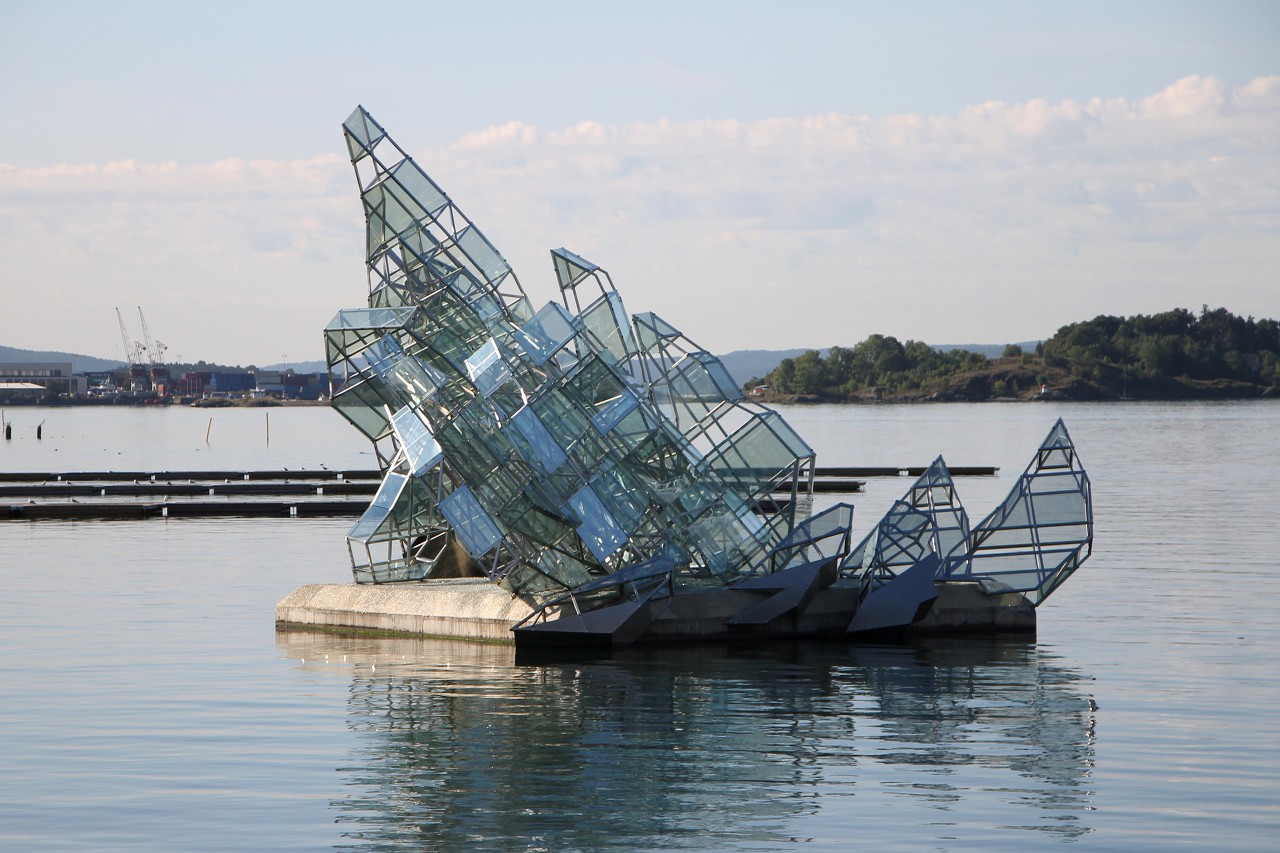
Opposite the theater, in the waters of the Bay, you can see the
sculpture "Hun ligger", made by Monica Bonvicini in 2007. The structure
made of metal and glass is
interpretations of a painting by the German artist Caspar
David Friedrich "The Sea of Ice" (Das Eismeer), written in 1923-1924
years...read more 
Bjorvika District
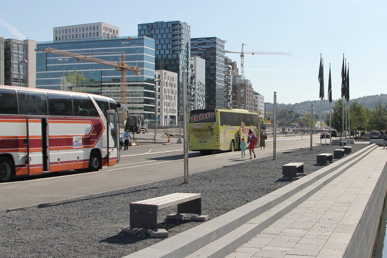
Kirsten Flagstads Square offers views of the development around the new central station, opened in 1980. This area was created on the site of an old container port and an
industrial zone, it is a logical continuation of the ultramodern
building of the Opera House and has become the new cultural and business
center of the city...read more 
Vigeland Sculpture Park (Frogner Park)
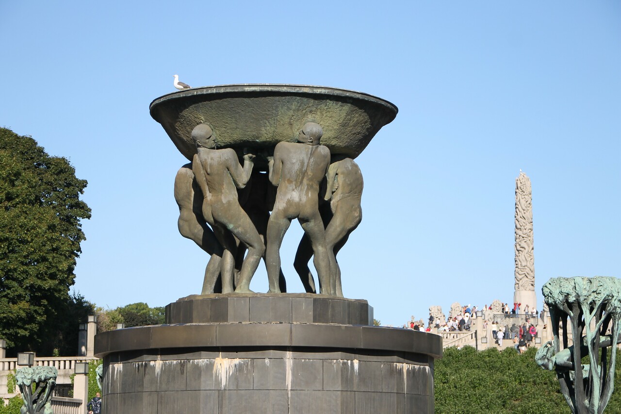
To the west of the center of Oslo is the district of Frogner, the
Northern part of which occupies a large green array Frognerparken,
better known as the "Sculpture park of Vigeland" (Vigelandsparken). This
is the most visited attraction of the Norwegian capital, for the year
there are about a million tourists...read more 
The Bygdøy Peninsula. Royal Farm and Museums
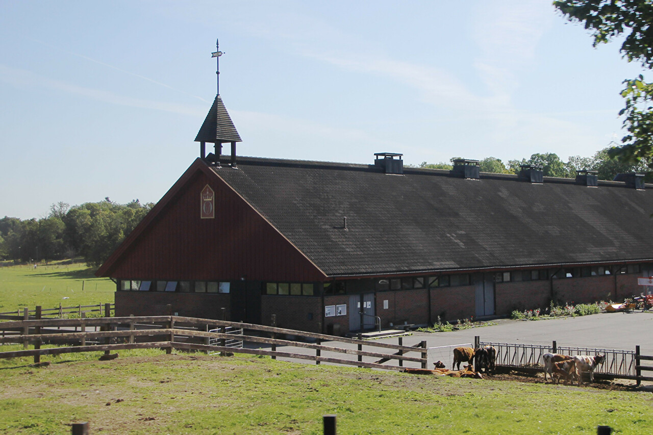
One of Norway's oldest cultural landscapes, the Bygdøy Peninsula was
once the only inhabited area in the inner part of the Oslofjord. The
Cistercian monks were the first to settle here, and in 1532 the land was
confiscated for the royal farm (Bygdø Kongsgård), which still exists
today...read more 
Norwegian Museum of Cultural History (Norsk Folkemuseum)
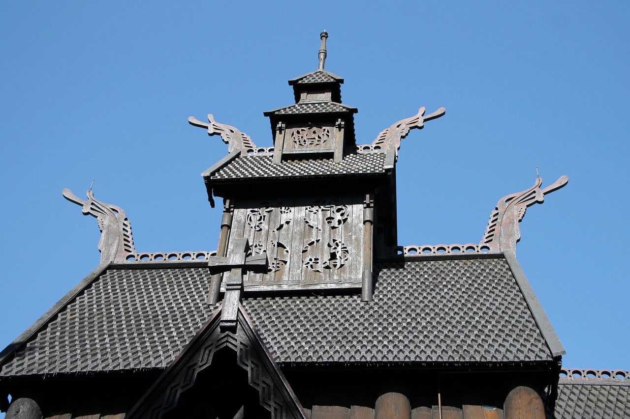
When visiting Oslo for the first time, tourists traditionally visit the
Norwegian etnographic museum (Norsk Folkemuseum), which is the same
symbol of the city as Vasa ship museum in Stockholm or Sibelius monument
in Helsinki...read more 
Fridtjof Nansens Plass
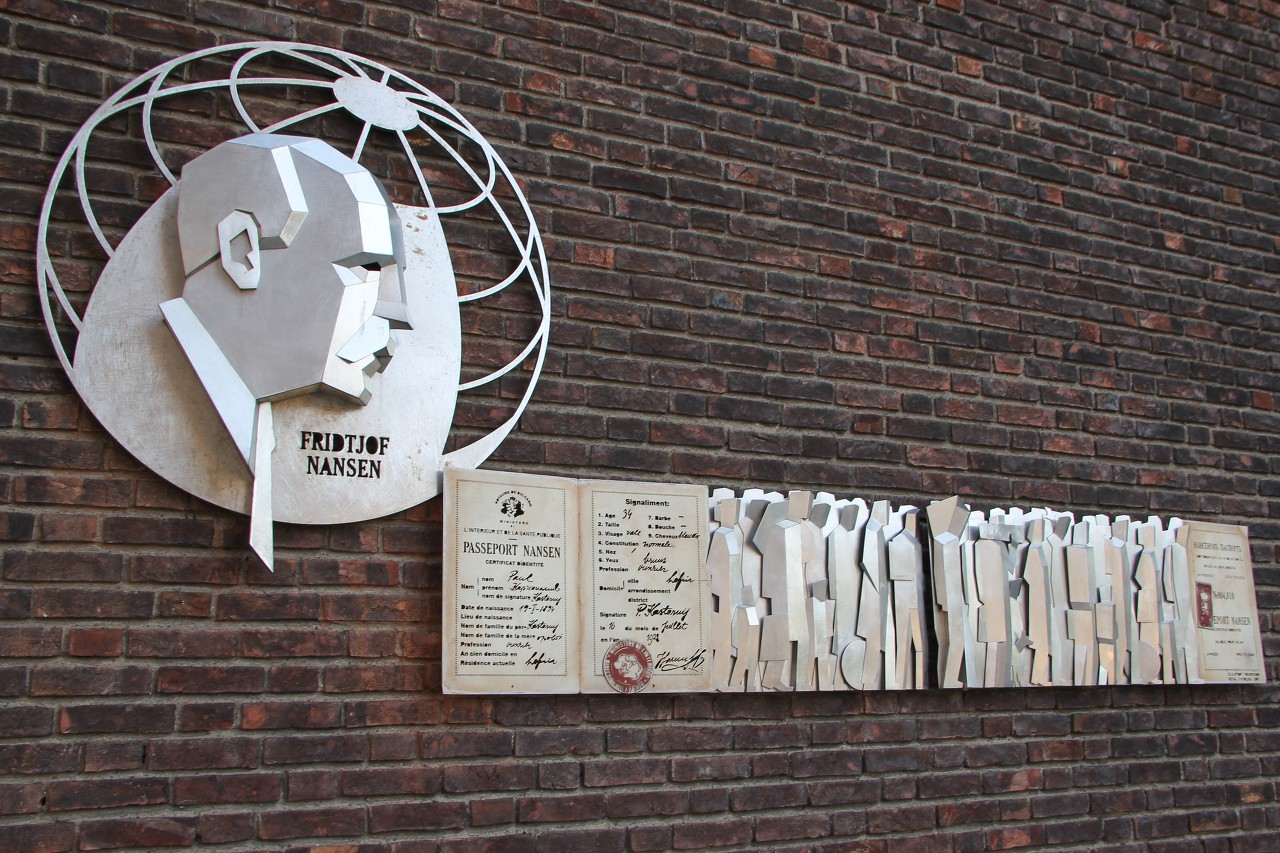
The masin square of Oslo is named after the famous polar explorer
Fridtjof Nansen. In 1918, the city authorities announced a competition
for the development of the city center, which was won by famous
architects Arnstein Arneberg and Magnus Poulsson...read more 
Oslo Сity Hall History and Architecture
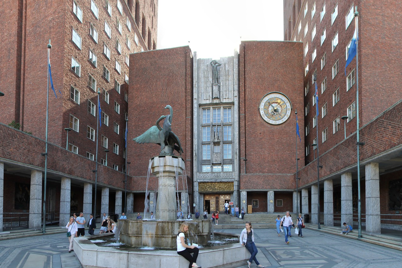
The
most notable building of Fridtjof Nansen square, and perhaps the entire
Norwegian capital, is Oslo City Hall (Oslo rådhus) it is an outstanding
monument of Scandinavian architecture in the first half of the 20th
century...read more 
Sculptures and Bas-reliefs of Oslo City Hall
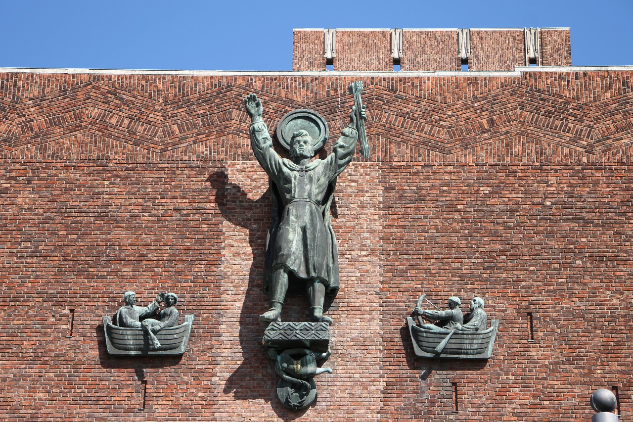
The City Hall is richly decorated with sculptures and bas-reliefs made
by famous Norwegian artists. The square in front of the main entrance to
the town Hall is decorated with a fountain with two bronze swans
(Svanegruppe) by the sculptor Dyre Vaa...read more 
Wooden Bas-reliefs by Dagfin Werenskiold
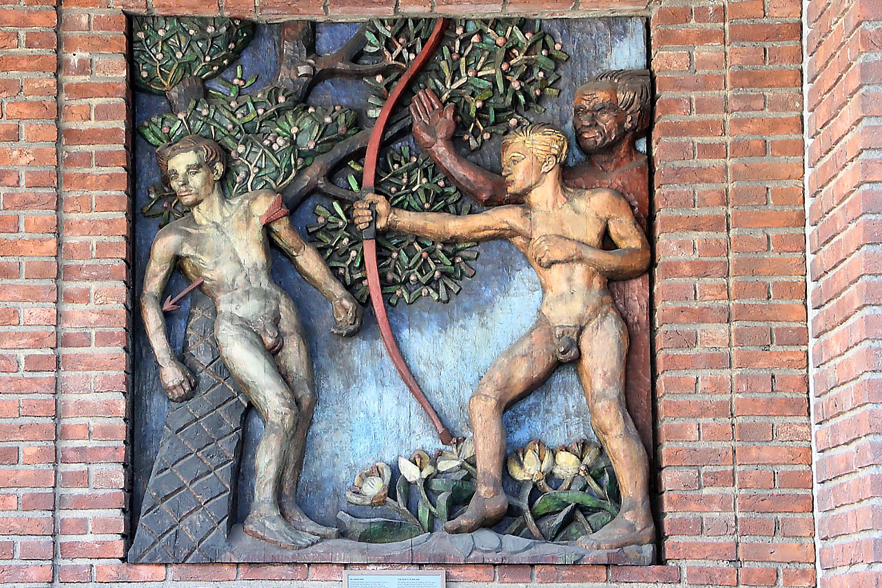
The galleries that run from both sides of the main entrance to Oslo City
Hall are decorated with polychrome wooden bas-reliefs created based on
Norse mythology by the artist Dagfin Werenskiold in the 40s and 50s.
There are 16 reliefs in total, their dimensions are 2.2 by 2.3 meters,
and the thread depth is up to 25 cm. Let's get to know some of them...read more 
Town Hall Square (Rådhusplassen)
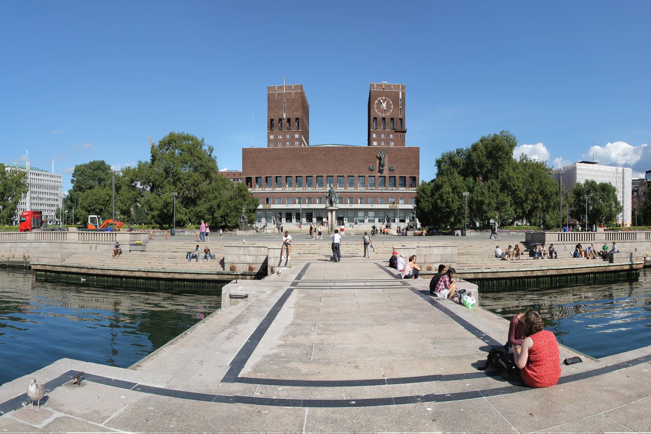
Paved with grey granite Rådhusplassen is located in front of the
southern facade of the Town Hall building and forms a single
architectural ensemble with it...read more 
Synken Sculpture Complex
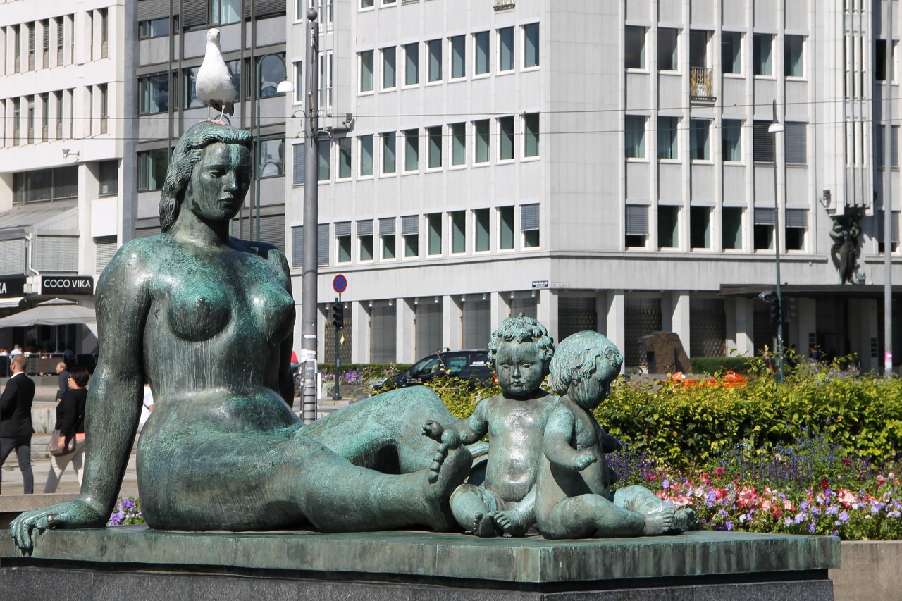
In 1939, the municipality of Oslo announced a competition for the design
of the town hall square, the winner was the project of the composition
"Sinken", presented by sculptors Emil Lie and Per Hurum...read more 
Pipervika Bay, Oslo
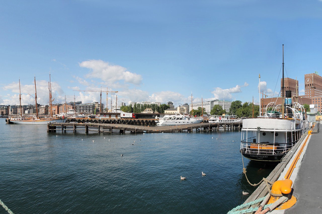
Pipervika is one of the bays of Oslofjord, which cuts right into the
city center. There used to be a trading port, and the shores were
crowded slums. In the early 20th century the city authorities launched a
project of complete reconstruction the shores of the Bay-the port was
taken out of the center, leaving only passenger berths...read more 
Akershus Fortress
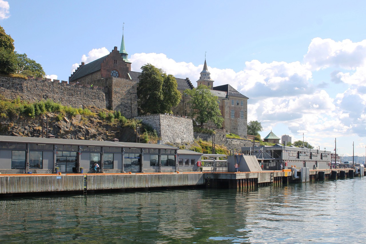
Akershus castle and fortress (Akershus Slott og Festning) is one of the
most important fortifications in the history of Norway. In 1287, the
Royal residence of Håkon V Magnusson in Oslo was attacked by the army of
the rebel nobleman Alv Erlingsson, resulting in the city being burned
and looted...read more 
Stallgården Bastion, Akershus Fortress
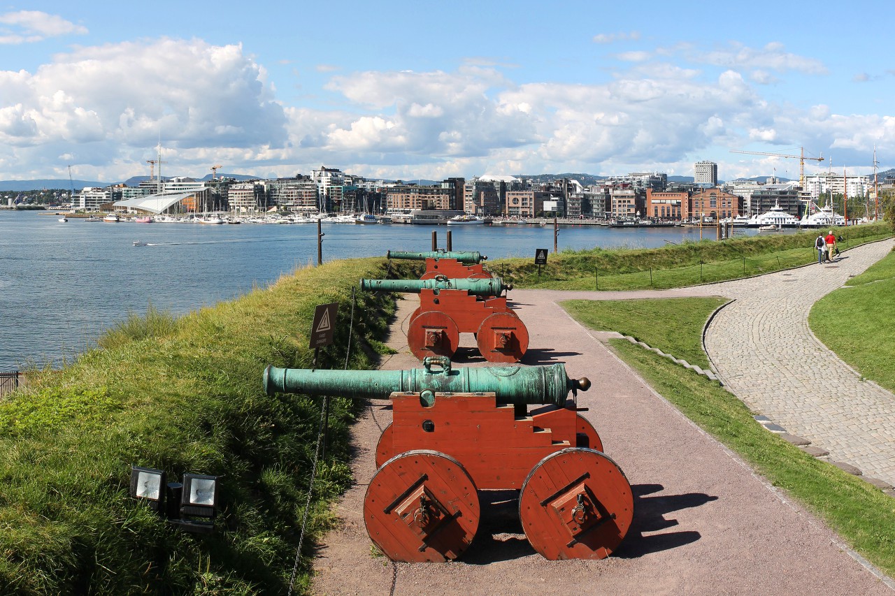
Usually tourists enter the fortress through the main entrance from the
Counterescaret Park, but I took a walk along The piperwyck Bay wharves
and started exploring the fortress from its southern tip. Here, the
fortress is entered by a gate next to the munks tower (Munks tårnet)...read more 
Prince Carls Bastion, Akershus Fortress
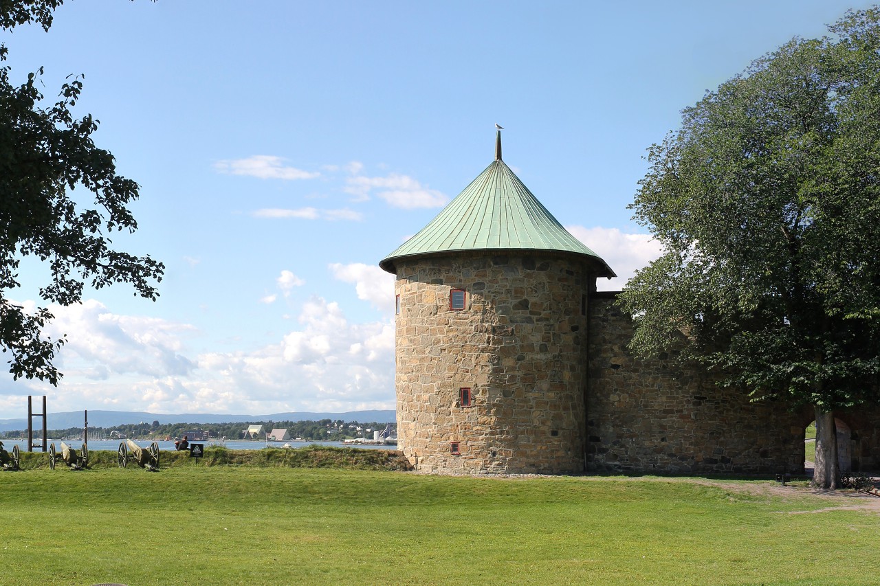
After the construction of the Stallgården bastion, which protected the
western flank of the fortress, was completed in 1616, work began to
strengthen the fortress from the south. A stone wall was built with a
height of about five meters, its length on the south side is about 80
meters, on the east 50 meters...read more 
Maiden's Tower of Akershus Fortress
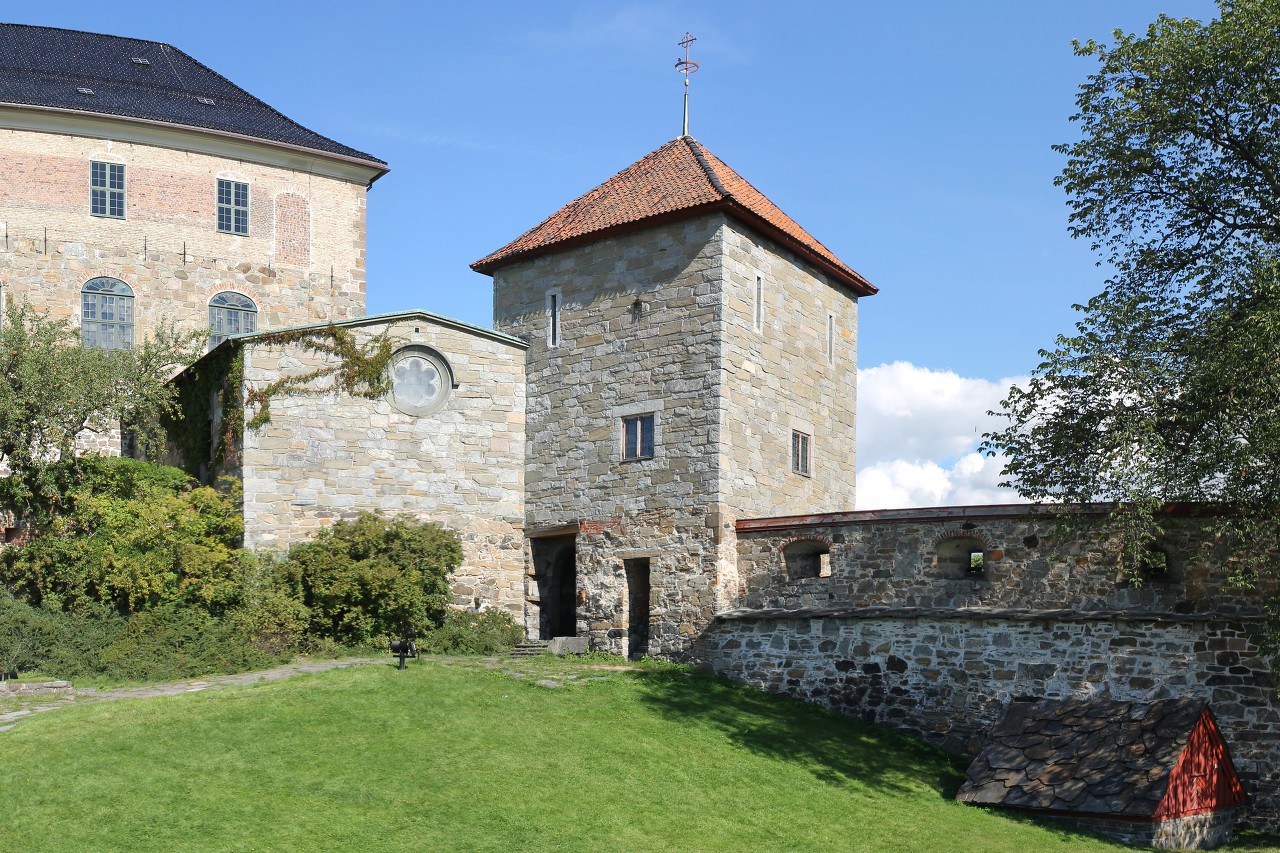
The southern tower of the castle, which is called "Maiden"
(Jomfrutårnet) was built in 1299-1304 on a rock base and for a long time
served as the main entrance to the castle...read more 
Romeriks Bastion and Knutstårnet Gate, Akershus Fortress
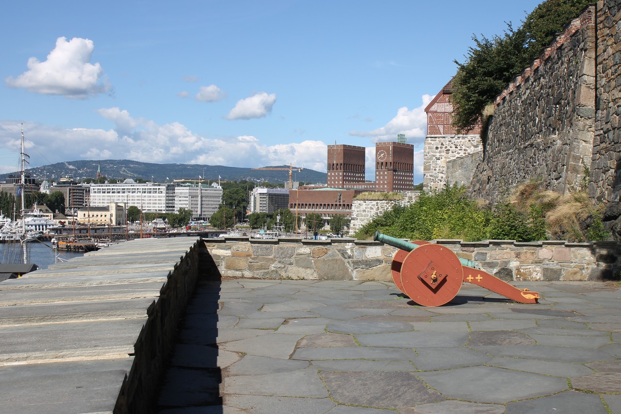
Now you can get inside the citadel by climbing the path that runs along
the western side of the castle. The entrance to the fortress is
protected by a small fortification with loopholes, built in 1770...read more 
Akershus Castle
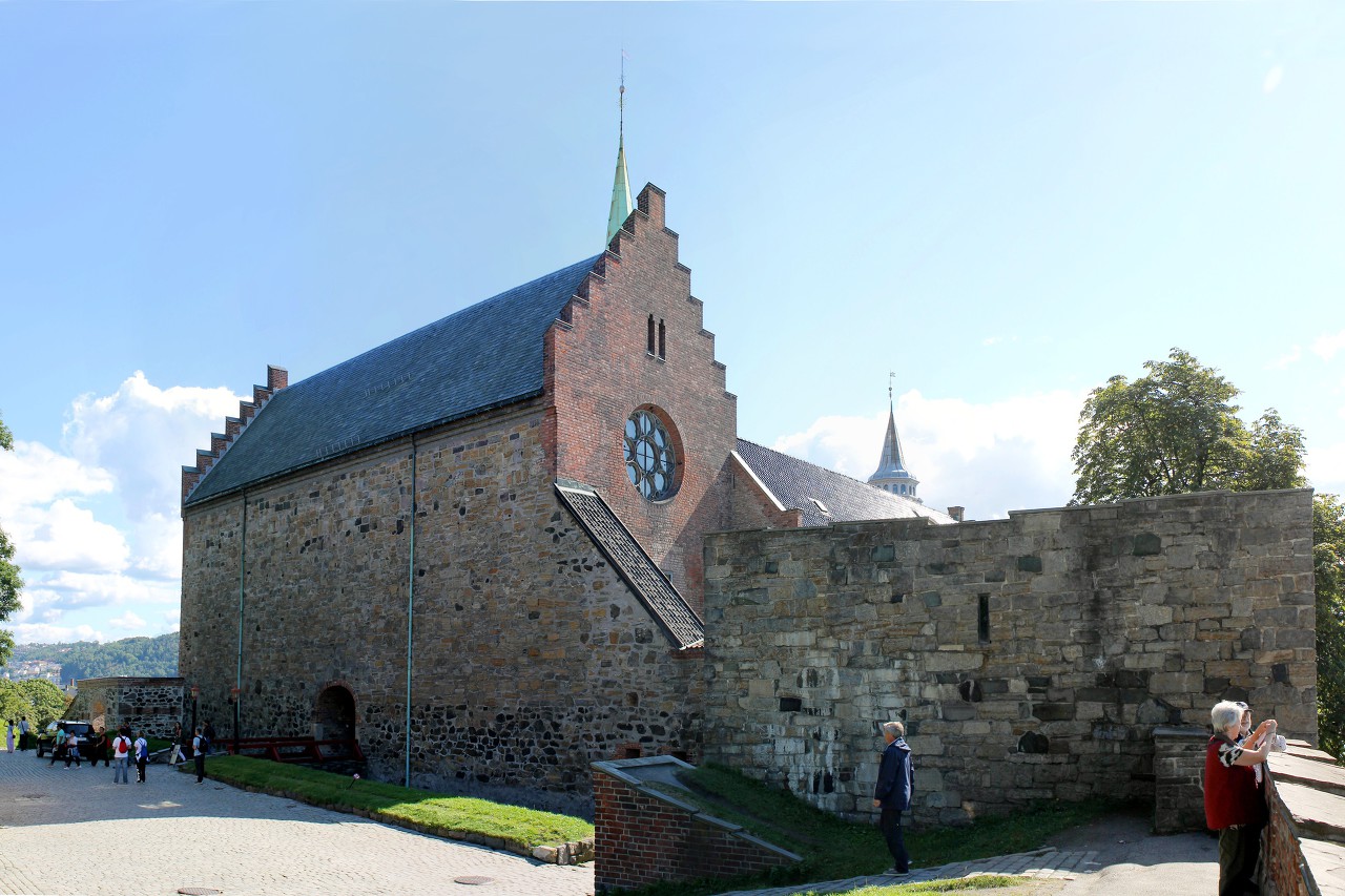
The Central part of the fortress is occupied by the castle (Akershus
slott). To avoid confusion: first Akershus castle was built, and much
later around it appeared fortifications, forming the fortress of
Akershus. The north wing of the castle was built in 1299-1304 as the
personal apartments of King Haakon V...read more 
Royal Bastion of Akershus Fortress
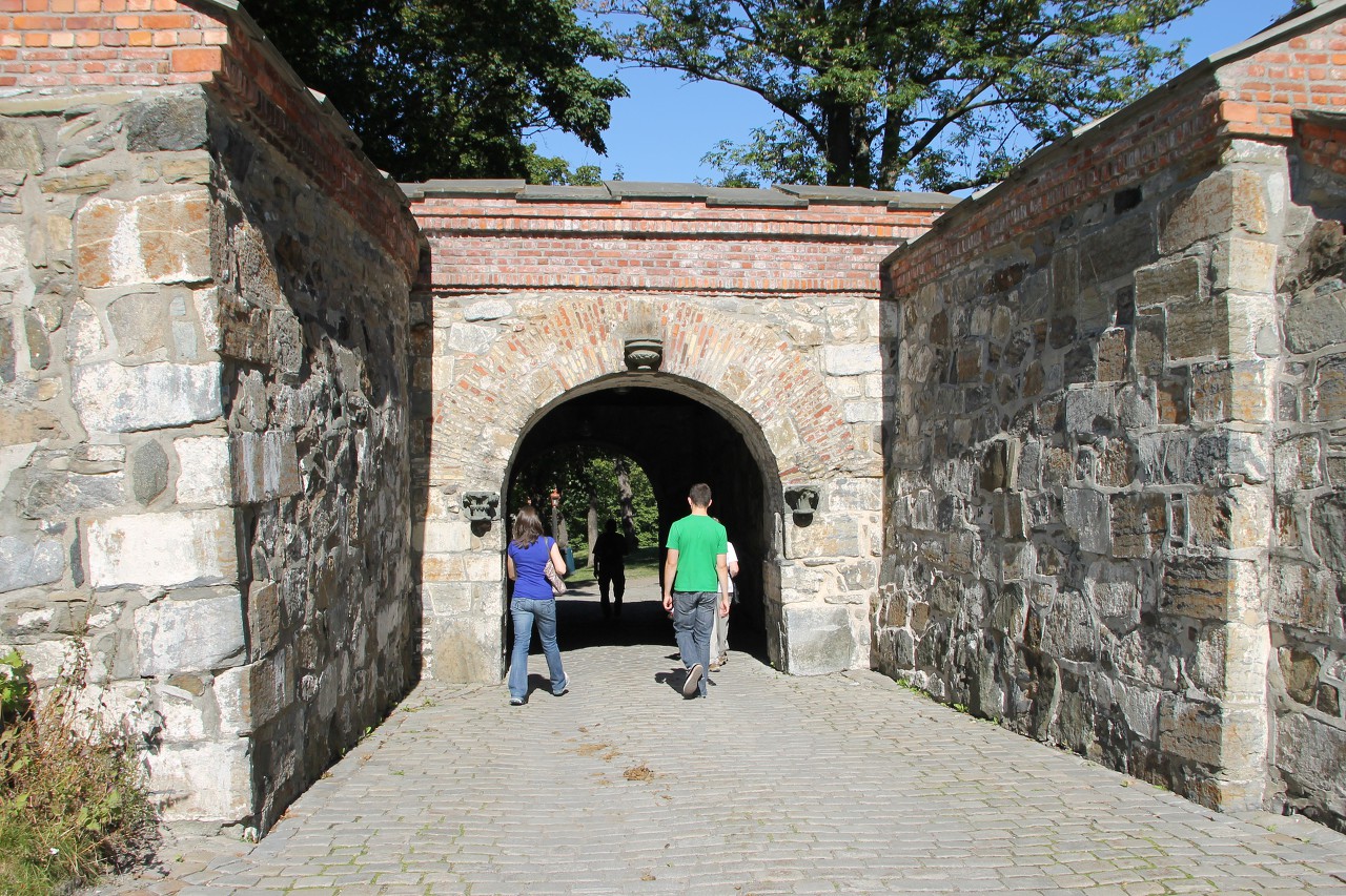
The Royal Bastion (Kongens bastion) was erected
after the seven-Year Northern war (1663-70), which resulted in the fortress
twice it was attacked by the Swedes and suffered serious damage. The city was there
completely destroyed...read more 
Kontraskjæret Park
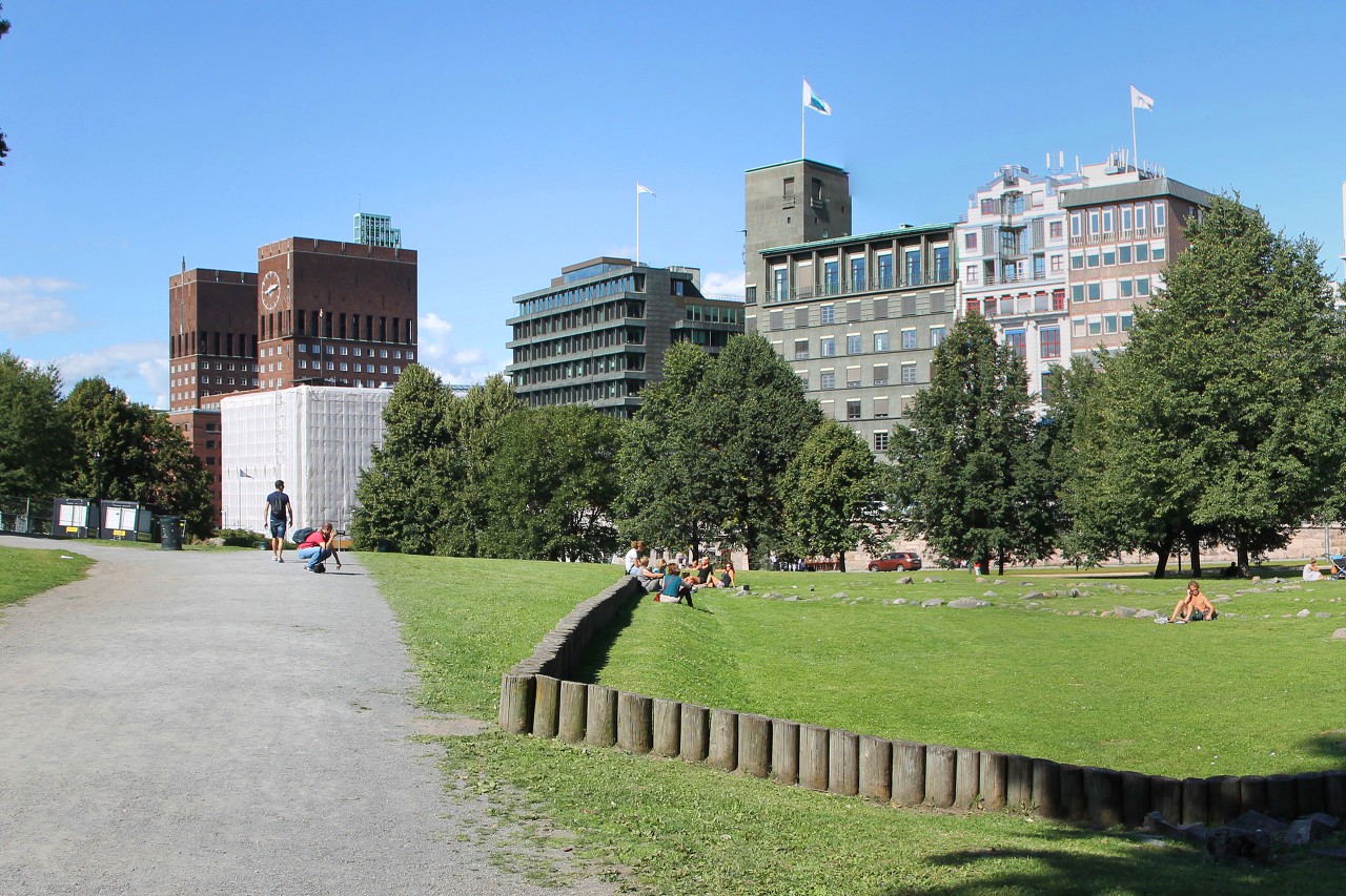
To the north side of the Akershus fortress borders the Kontraskjæret
park. The name comes from the French word "contrescarpe", this
fortification was located on the site of the current park. Later, when
the formation Christiania city around the fortress, this place was
gradually built up with houses of artisans...read more 
Rådhusgata Street
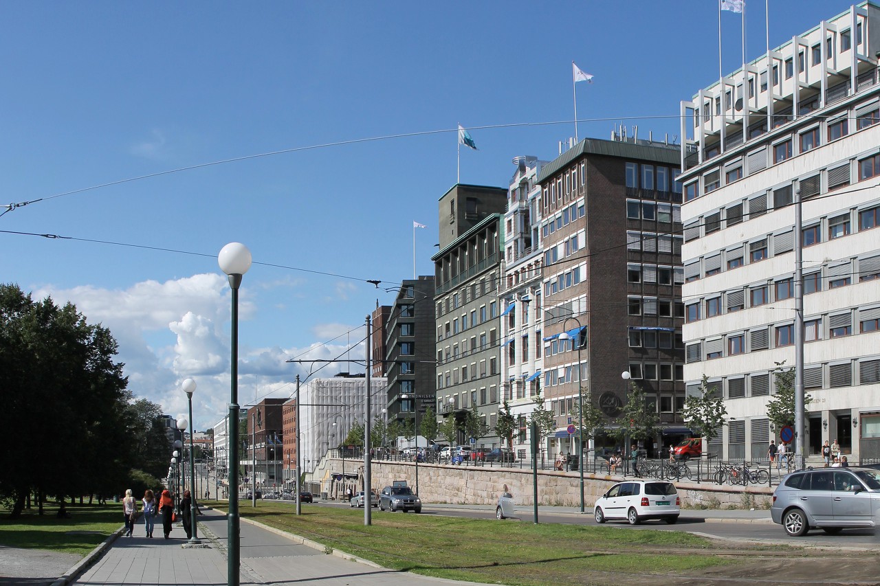
At the Kontraskjæret park, the Rådhusgata street begins, extending from
the town hall square to the Bjørvika bay, which was the main
thoroughfare in old Christiania. Now most of the street has modern
buildings, but there are several houses of the 17th and 18th centuries,
including the old town hall...read more 
Christiania Torv
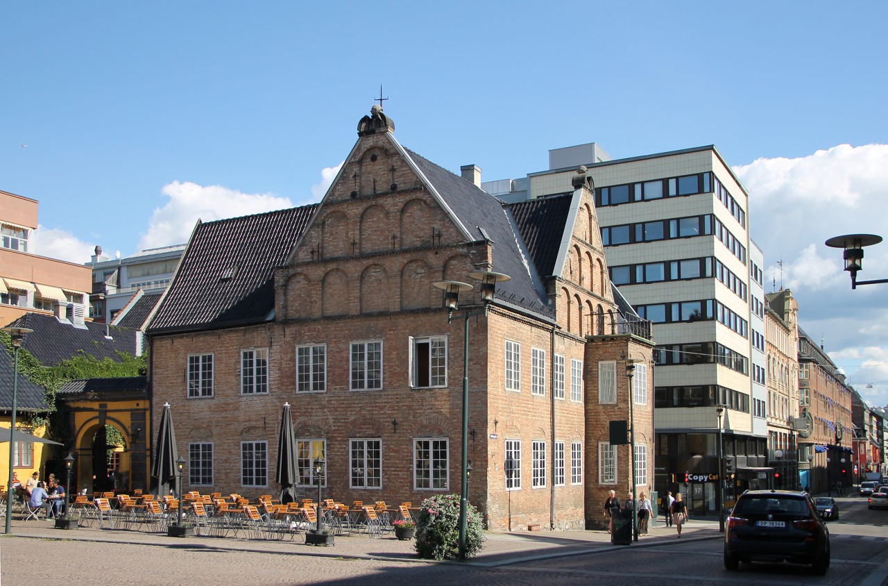
Christiania square (Christiania Torv), the center of the old city and
one of its most beautiful places, is located three hundred meters east
of the Town Hall square...read more 
Glove of Christian VI fountain (Hansken)
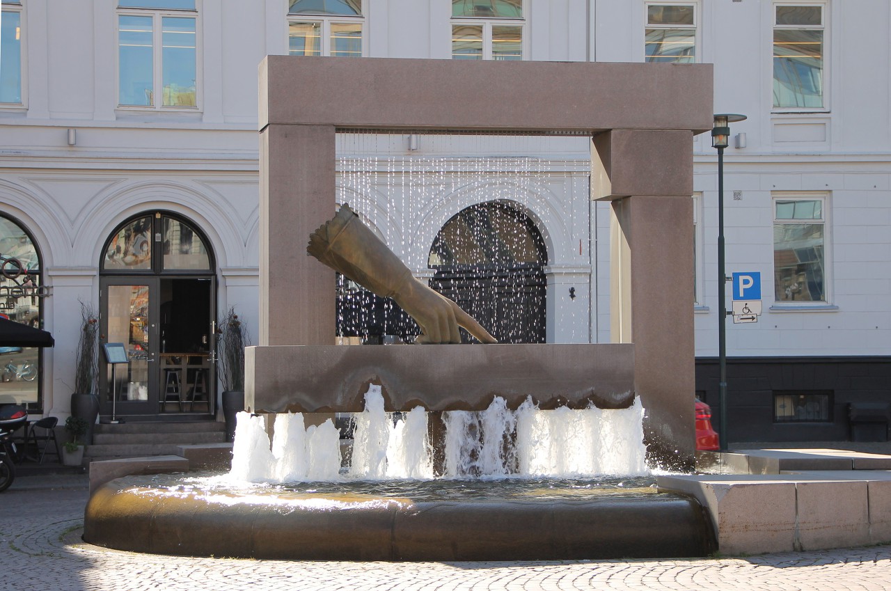
In centre of Christiania square there is a fountain-monument "Glove of Christian IV", better known as simply "Glove" (Hansken).
The composition is based on the legend that after the fire of 1624,
king Christian IV ordered to rebuild the city in a new place, pointing
his finger at the map slightly away from the burned-out quarters...read more 
Savings Bank Building (Sentralen)
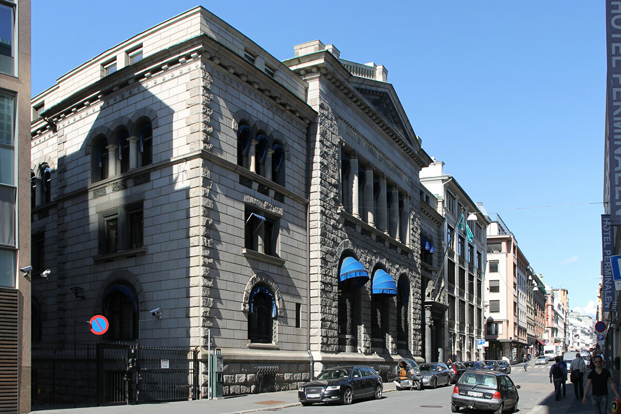
On Øvre Slottsgate street, 50 meters from Kristiania square, is the
headquarters of the savings Bank of Christiania, called Sentralen, built
in the national romantic style in 1901 by the architect Henrik Nissen...read more 
Tollugata Street
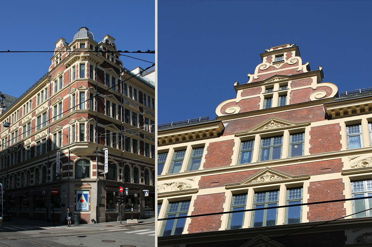
After walking a block from Christiania Square, I came out on Tollbugata, one of the first streets built after the 1624 Gorda fire. Old buildings
here, of course, are no longer left, the street was completely rebuilt
at the end of the nineteenth century...read more 
Prinsens Gate and Eidsvols Square
The street appeared in the middle of the 17th century, also after a fire
in
1624, and was originally built up with one-story half-timbered artisan
estates. The oldest surviving house on the street dates back to 1640.
The fire of 1858 was a turning point in the fate of the street, when it
burned down more than 40 houses...read more 
Oslo DFDS Terminal, Ferry to Copenhagen
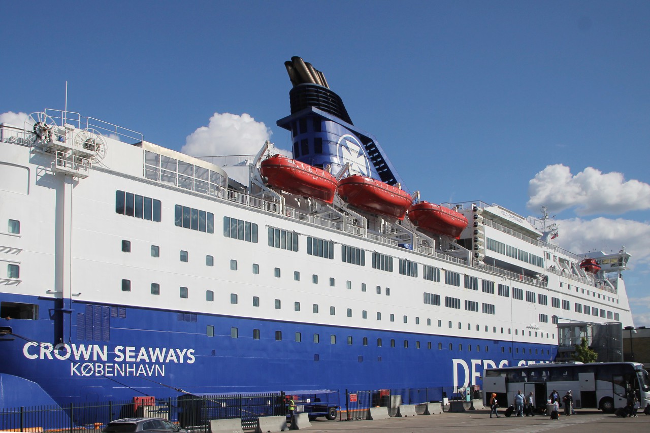
My walk through the Norwegian capital ended at the DFDS terminal, at the
tip of the Akersnes Peninsula, where the Akershus fortress is located.
From the town hall square to the terminal about a kilometer and it is
quite possible to walk for 10-15 minutes...read more 
Bjorvika Bay
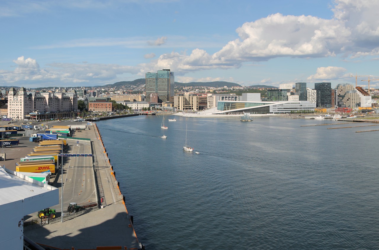
After passing the control, I boarded the ferry, found my cabin and left my backpack there. There was still enough time before departure to view the Norwegian capital from the upper deck of the ferry, where I headed...read more 
Along the Pipervika Bay
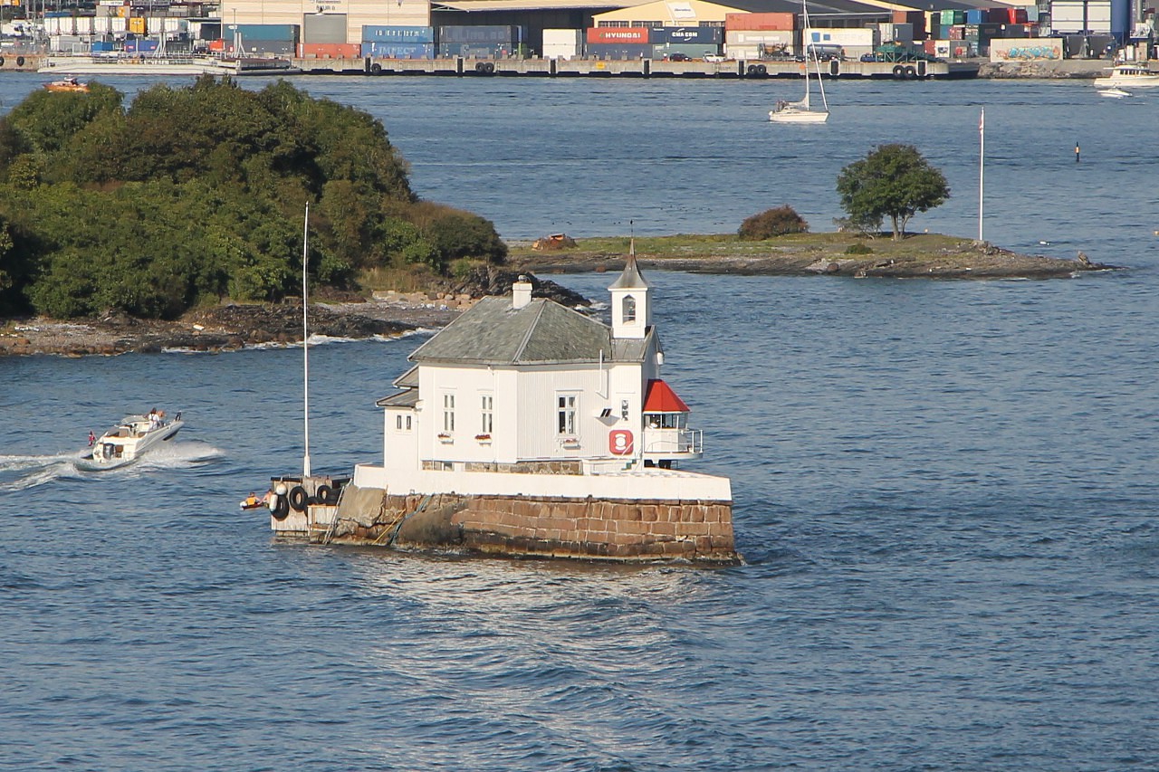
At 17:00, our ferry left the DFDS terminal and went on a voyage to Copenhagen. We go around the Vippetangen cape, the southern tip of the Akersnes
peninsula. The name of the cape is translated simply as "vippefyr" -
lighthouse, "tagen" - cape. There was a lighthouse here, but it was a
long time ago. Now on the cape stands an elevator-granary, built in 1905...read more 
Along the Oslofjord
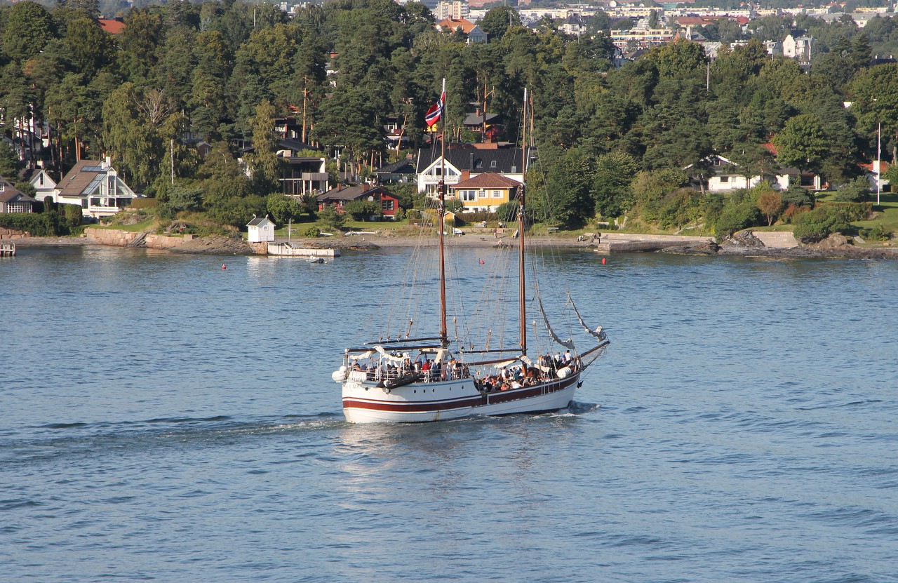
The shores and bays of Oslo were left astern. But until we say goodbye
to Norway, our ferry will take several hours to go along the Oslo fjord
to the Skagerrak Strait. The fjord cuts deep into the land for 102
kilometers, the Norwegian capital is located at the very end of it...read more 